Asharodi–Jhajra and Rispana–Bindal Elevated Corridors: District Administration Speeds Up Action; DM Issues Strict Directives
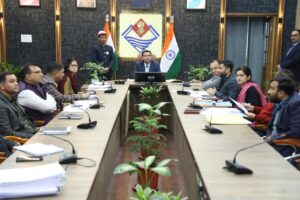
Dehradun: The district administration has intensified efforts to fast-track the proposed Rispana–Bindal elevated corridor and the Asharodi–Jhajra project on NH-7. Chairing a review meeting at the Rishiparna Auditorium on Thursday, District Magistrate Savin Bansal instructed officials of all concerned departments to accelerate land acquisition, rehabilitation, and other project-related procedures within the scheduled timelines.
Calling the Rispana–Bindal elevated road a priority project of the Chief Minister, the DM directed the Municipal Corporation of Dehradun and the MDDA to furnish their respective land records without delay. The Elevated Corridor Survey Committee has been asked to prepare a comprehensive, department-wise report of all affected land parcels.
PWD and revenue teams were instructed to remain present on-site and compile a detailed list—using the prescribed format—of individuals who have encroached upon government land falling within the project alignment. The DM said that after consolidating the department-wise land records, the preliminary land acquisition notification under Section 11 must be issued promptly, followed by expeditious initiation of rehabilitation and resettlement processes.
Addressing issues raised in East Hope Town and Arcadia Grant, particularly the obstruction by villagers and the pending compensation for structures on Forest Department land related to the NH-7 Asharodi–Jhajra corridor, the DM directed NHAI authorities to conduct joint site inspections with SDM Sadar and SDM Vikasnagar and resolve all bottlenecks at the earliest.
He further instructed officials to take swift, coordinated action with the police and respective SDMs for road improvement and the removal of illegal encroachments along the Dehradun–Haridwar highway.
During the meeting, PWD officials briefed the DM on the progress of the elevated corridors. The alignment of the Rispana–Bindal elevated stretch has been finalized and forwarded to NHAI for approval. The proposed elevated corridor along the Rispana River spans 10.365 km, impacting 49.04 hectares of land—comprising 42.89 hectares of government land, 4.01 hectares of private land, 2.1 hectares of forest land, and involving 1,022 structures.
The Bindal corridor will extend 14.264 km, affecting 55.90 hectares, including 31.07 hectares of government land, 15.67 hectares of private land, 2.22 hectares of forest land, and 6.92 hectares of defence land. A total of 1,656 structures—both temporary and permanent—fall within this alignment.
Senior officials present at the review meeting included SLAO Smrita Parmar, SDM Kumkum Joshi, SDM Sadar Harigiri, SDM Vinod Kumar, Deputy Municipal Commissioner Gopal Ram Binwal, NHAI Regional Officer Vishal Gupta, PWD SE O.P. Singh and others.